This page illustrates the MP’s briefing.
Two videos and slide shows:
Map of Stonehenge World Heritage Site below shows:
- Route of A303 Stonehenge road widening scheme where it crosses the World Heritage Site
- The 3.3km tunneland portals across the 5.4km wide WHS
- Extent of National Trust land holding (shown in green).
- The Stonehenge ‘triangle’ managed by English Heritage, (shown as a white triangular area).
- Key archaeological monuments (in brown).
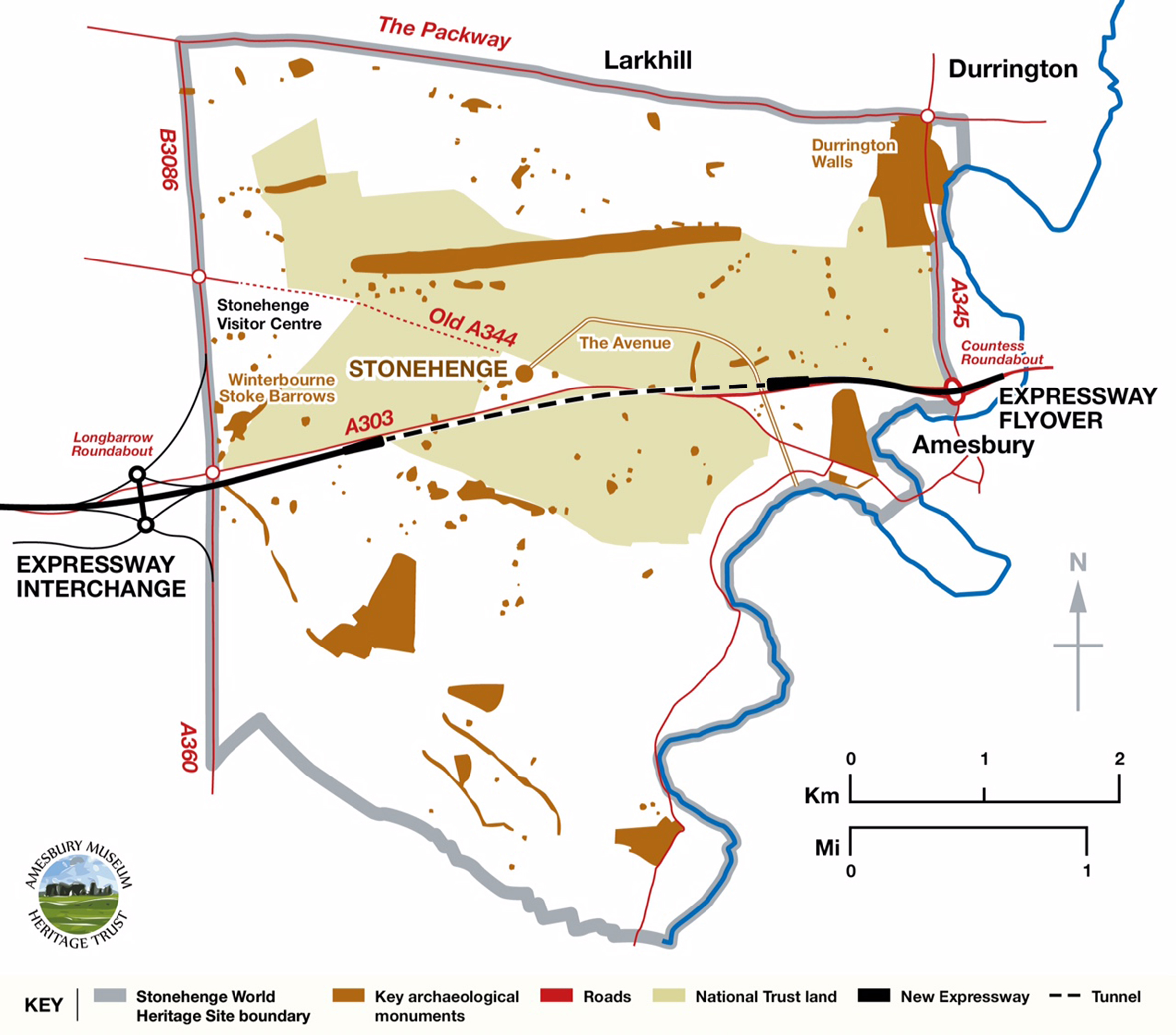
© Stonehenge Alliance, supported by Amesbury Museum and Heritage Trust.
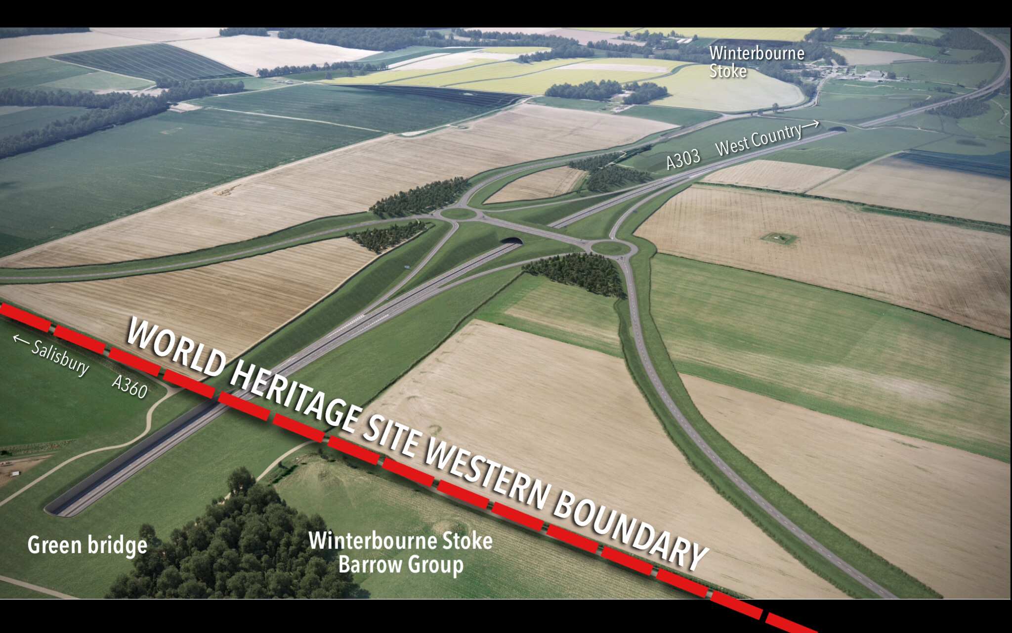
Map below shows National Highways’ 8 mile road widening scheme between Amesbury to the west and Berwick Down to the east, including:
- Flyover junction at Countess
- Eastern tunnel entrance
- The tunnel within the WHS
- Western tunnel entrance
- Above ground cutting towards new junction
- Viaduct over the River Till
- Winterbourne Stoke bypass.
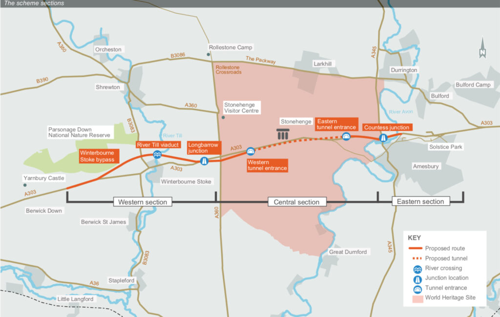
Map and scheme overview plan by National Highways
Diversion routes:
When the Stonehenge Tunnel is closed e.g. for maintenance, technical failures, incidents or crashes, the proposed alternative purple and green routes would go through the residential areas such as Countess Road, Amesbury, Larkhill, Bulford and Durringtlon roundabout. Choice of route would depend on vehicle size. The hatched area and red lines show the extent of the construction zone over a five year period.
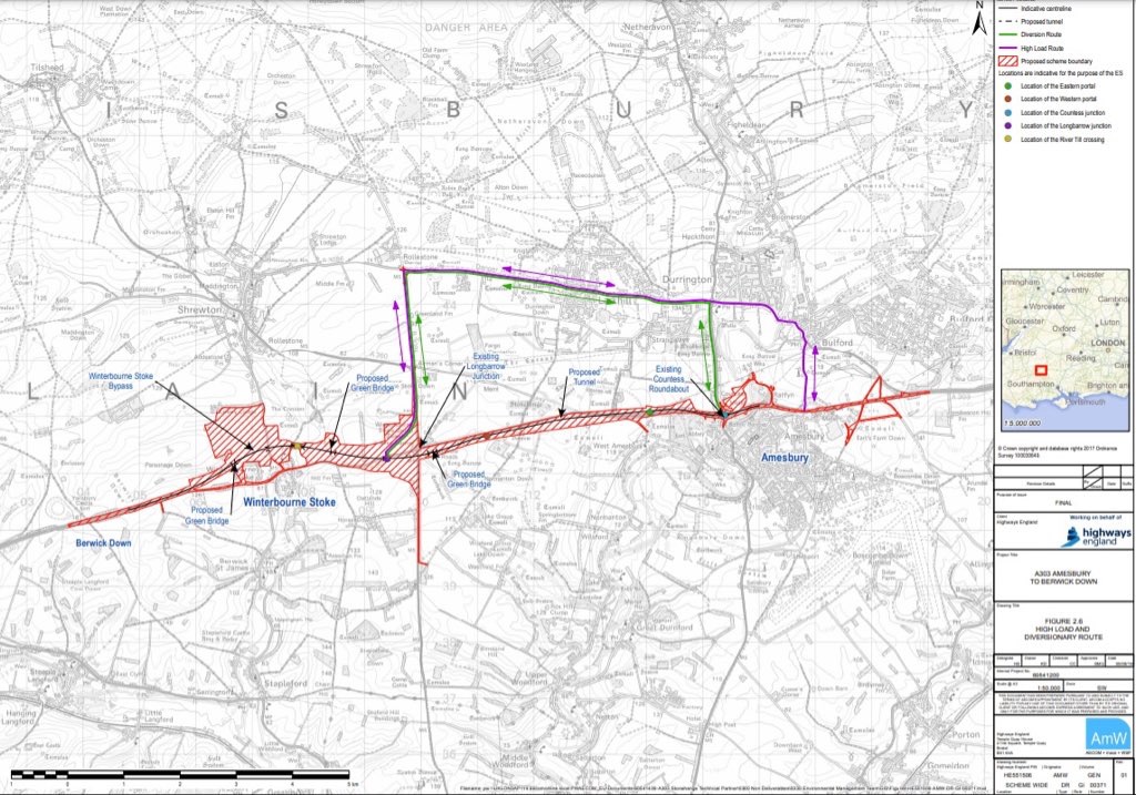
Map of diversion routes plan. The red outline and hatching shows the scheme’s construction boundary. See also National Highways’ plans here.
Exiting western tunnel portal onto slip roads leading to new motorway style junction on the WHS boundary.
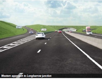
Visualisation of slip roads leading to motorway style junction to the A360 and Stonehenge Visitor Centre. The still is from a video by National Highways.
New Expressway Junction with slip roads outside the boundary of the World Heritage Site, but within its setting. It replaces the current nearby Longbarrow Roundabout.
New double roundabout in the setting ot the World Heritage Site. Image by National Highways. Labels by Stonehenge Alliance
Plan of cutting and visualisation of western tunnel entrance close to former A303:
Plan shows proximity of the downgraded A303 to the tunnel entrance and chasm. In the visualisation below, pedestrians can be seen walking on the former A303, downgraded to a restricted byway, overlooking the vast chasm at the western end of the World Heritage Site. The noise experienced by cyclists and walkers from fast moving traffic would be considerable, far greater than at present.
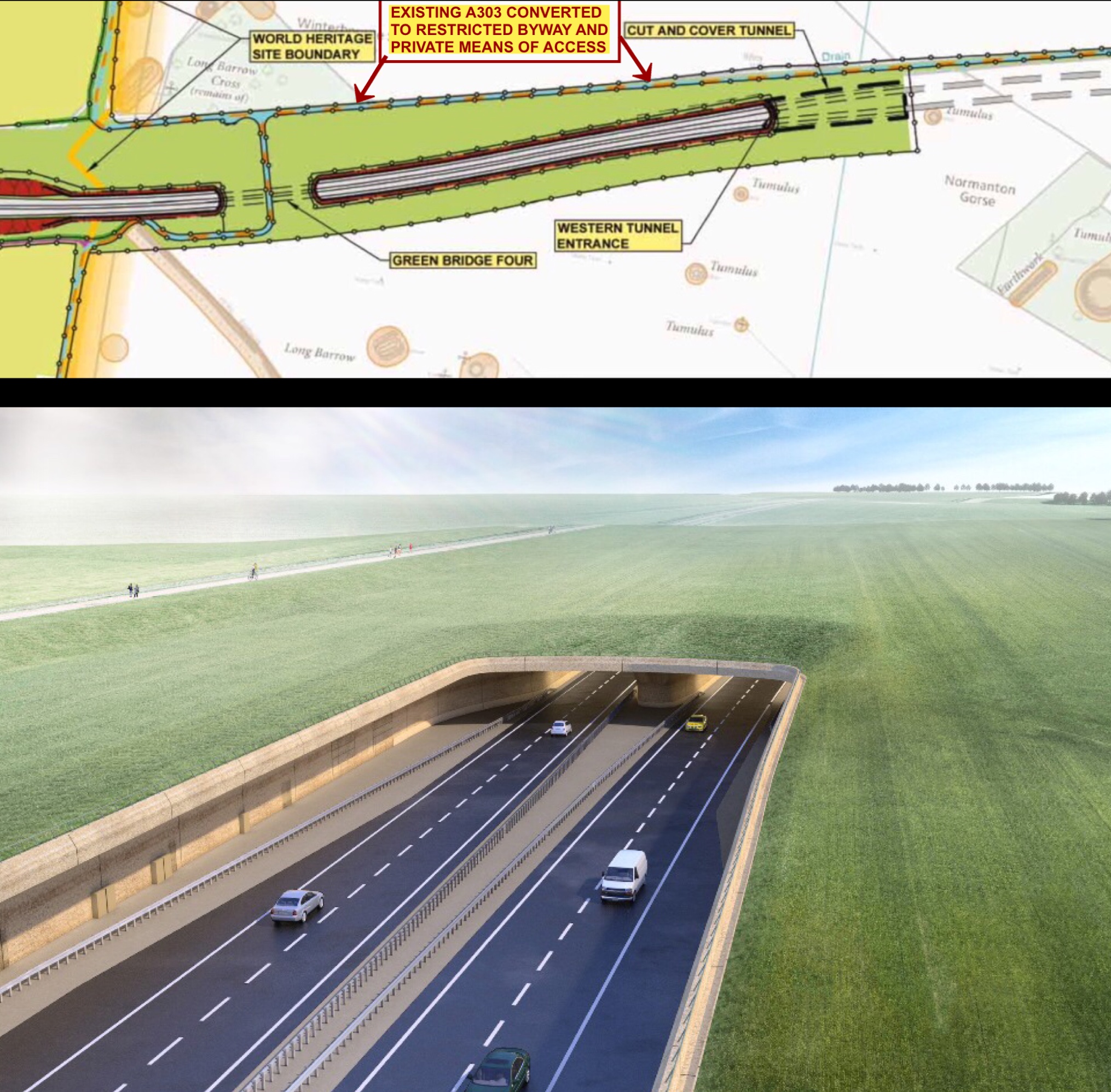
Top: Plan extract. Bottom: Western tunnel portal. Note old A303 downgraded to restricted, fenced Byway for pedestrians, cyclists and access. Plan and Visual by National Highways.
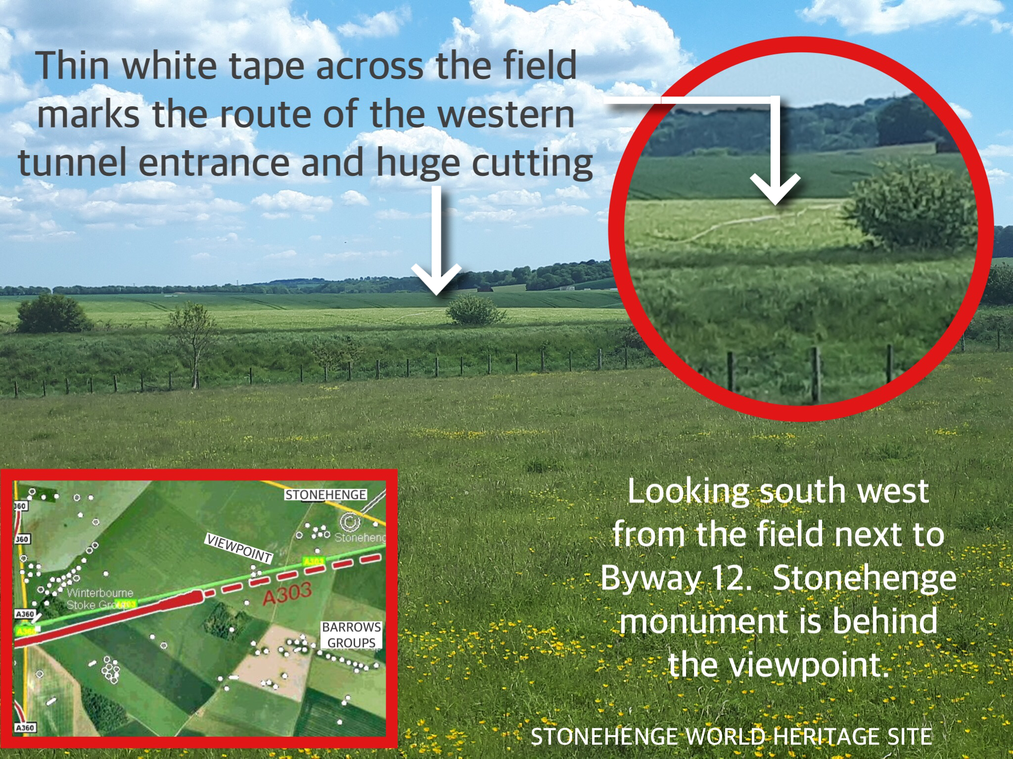
The cutting at the western end of the World Heritage Site:
Before and after images below: Field as it is in the summer and visualisation of the cutting at the western end as seen from ‘green bridge four’ (see plan above), looking towards the western tunnel portal.
The cutting will be deeper than the tallest stone at Stonehenge, which stands at 6.5m high. The cutting includes infrastructure for control centre/room (right). No standard lights are shown nor planned in order to maintain a dark sky. Wiltshire Council expressed safety reservations.
The area of land taken out of the World Heritage Site landscape to construct the cutting and western entrance would be the equivalent of eight football pitches.
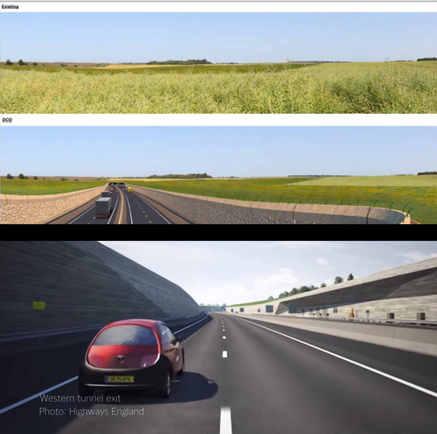
TOP: Field designated for cutting. MIDDLE: Visualisation of cutting from Green Bridge 4 viewpoint. BOTTOM: Still from video. Images by National Highways
Where will the deep cutting go?
A thin tape was pinned across the field marking the location of the new dual carriageway leading to the slip roads and junction of the new A303/A360 for the benefit of the Examining Authority in 2019.
A pair of tunnels:
Below is a visualisation of the east to west tunnel as it emerges at the western end. A west to east tunnel would run in parallel to this one.
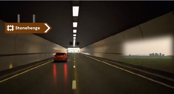
Emerging at western end: Image adapted by Stonehenge Alliance based on a still from National Highways video showing approximate location of obliterated view of Stonehenge monument.
Eastern end of the World Heritage Site:
Flyover travelling from east to west. Visualisation shows slip roads from Countess roundabout leading towards the eastern tunnel portal. The Grade II listed Amesbury Abbey grounds, Grade I listed building and Blick Mead archaeological site are immediately on the left.
Image source is a video still taken by National Highways, February 2018
Visualisation of eastern portal by National Highways. The Avenue would be not far from the tunnel entrance.
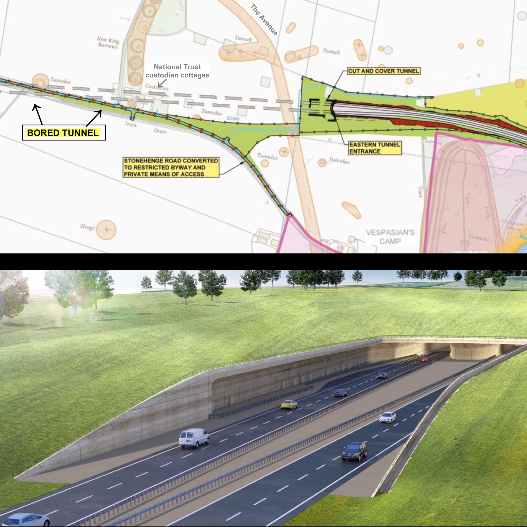
Top: Plan of eastern approach and tunnel. Below: Visualisation of eastern tunnel portal through land recently purchased by National Trust. Images by National Highways
Countess flyover at dusk:
Bird’s eye view of Countess flyover at dusk, travelling towards eastern tunnel entrance, past a Grade I listed building and the Mesolithic site of Blick Mead.

Image source: Private artist’s impression.
Illustrated summary verdict by Examining Authority:
Take action! Sign our international petition.
Please note: The Stonehenge Alliance has no connection with any other protest groups involved in direct action against A303 Stonehenge.
Please share